
Our Bespoke Service
What We Do
We provide fast, reliable 3D measured surveys with the rigour and insight only Architects can offer, delivering a bespoke service from initial consultation to handover that ensures speed, accuracy and quality.

Our services are designed to support design teams with precise, reliable information about existing buildings. We focus on projects of all sizes, from renovations and extensions to complex historic structures.
Measured Building Surveys
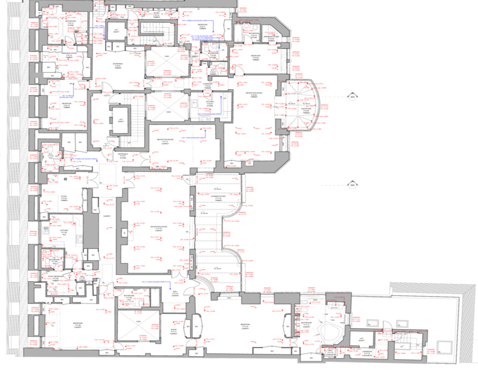
Highly accurate laser-scanned surveys capturing every detail of existing buildings. Delivered as precise plans, elevations, sections, and point cloud data ready for design teams.
Renovation & Extension Projects
Comprehensive surveys for remodelling, extensions, and adaptive reuse projects. Accurate information ensures confident design decisions and fewer surprises on site.
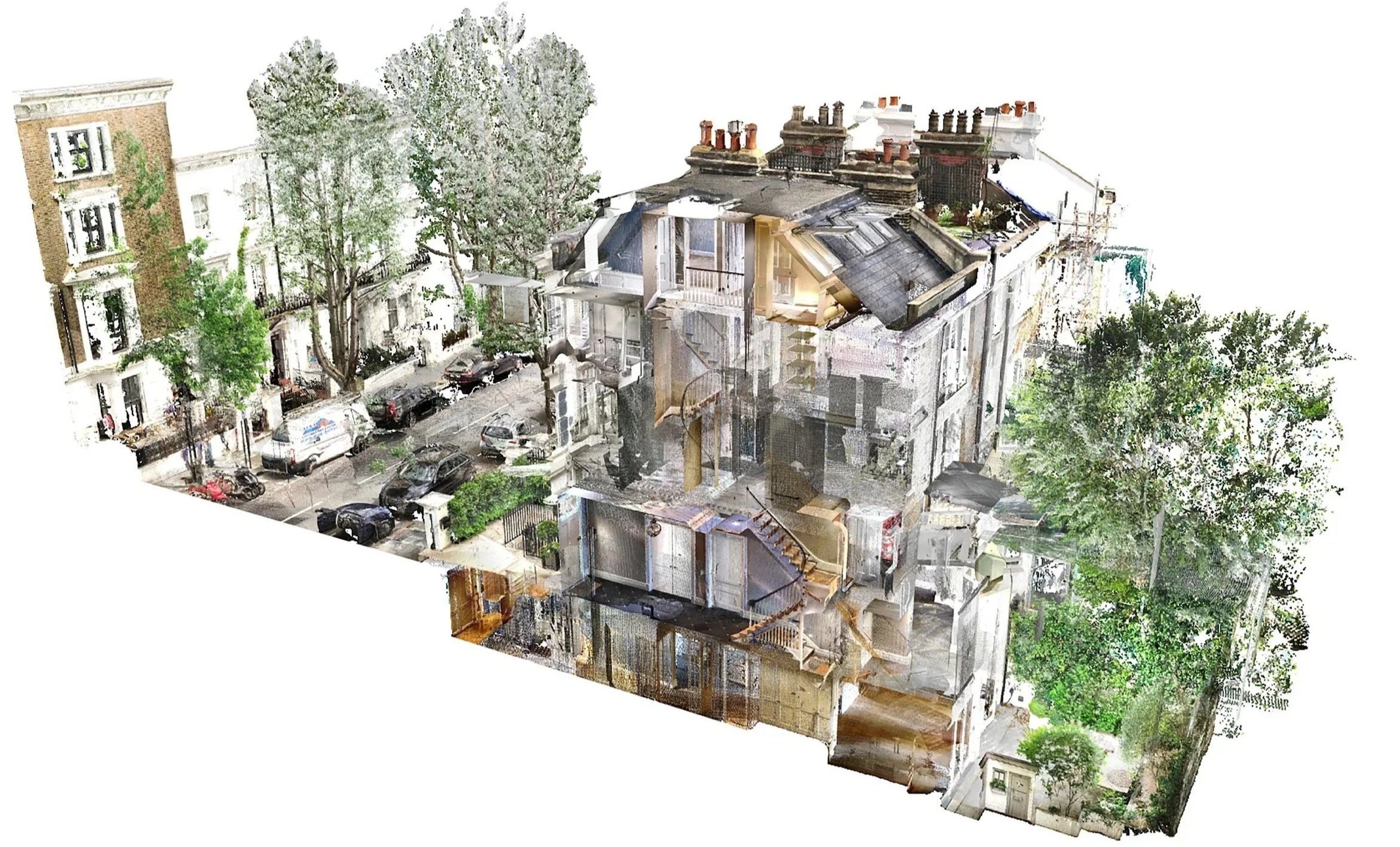
Laser Scanning & Point Cloud Data
Laser scanning captures intricate geometries and historic fabric with millimetre precision, making it ideal for listed buildings and technically complex sites.
BIM Models and Digital Deliverables
Detailed BIM models created from point-cloud data provide a complete digital representation of your building, supporting design, coordination, and construction.

How We Do It
Our surveys are architect-led, combining advanced technology with deep building knowledge to deliver outputs tailored to your project’s needs.
Consultation
We begin by understanding your project requirements, determining the level of survey detail needed, and defining the best workflow for data capture and delivery.
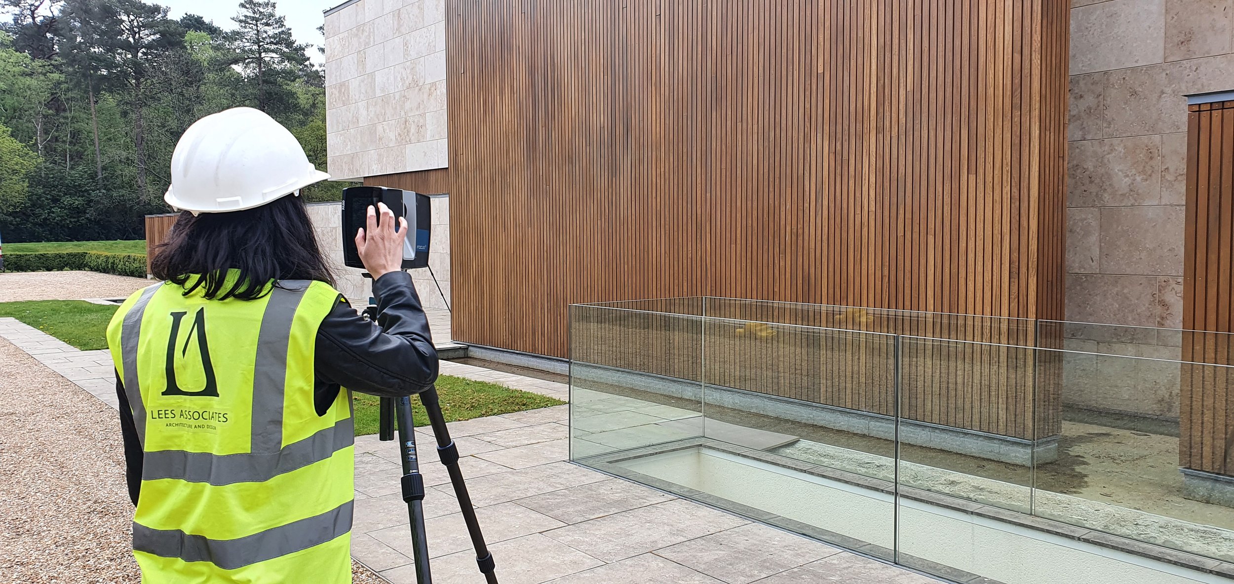
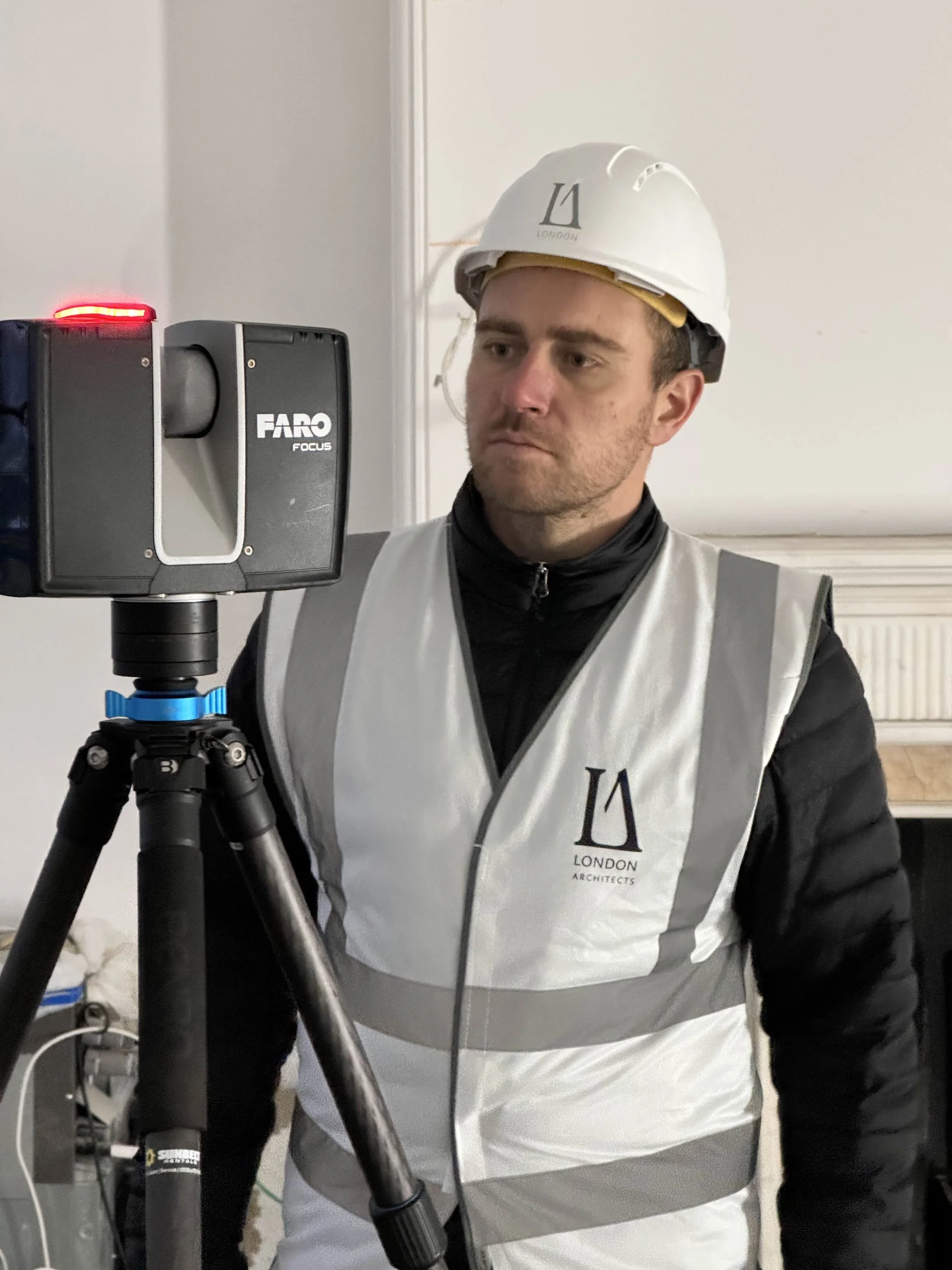
Scanning & Data Capture
Using state-of-the-art laser scanning, we record millions of precise 3D points across every surface of the building. Simultaneously, 360° panoramic photography is captured at each scan location, providing visual context alongside the spatial data.
Processing & Modelling
Scans are processed into a unified point cloud model, eliminating duplicates and ensuring geometric accuracy. From this, our team creates detailed BIM models and/or measured 2D drawings, aligned with your design requirements.
Delivery & Handover
All outputs — point clouds, BIM models, drawings, and photography — are delivered securely to your team, providing a complete and reliable digital record of the building.
Why It Matters
Architect-led surveys give design teams the confidence that the building has been accurately recorded, interpreted, and translated into information they can trust.
Accuracy & Reliability: Every dataset is checked by architects to ensure precision.
Time-Saving: Once scanned, all necessary information is captured for the project, reducing delays and repeat visits.
Visual Insight: Integrated 360° photography complements spatial data, enhancing understanding of materials, context, and spatial relationships.
Architectural Expertise: Surveys are informed by the knowledge of professionals who understand buildings, construction, and design workflows.