
The benefits of 3D scanning technology for construction projects
As both architects and surveyors, we are acutely aware of how vital it is to keep seeking new ways to save time and money for our clients on their projects. One of the principal reasons LA London established LA Surveys back in 2020 was because of the delays to our projects caused by what proved to be unreliable measured surveys that we had received at commencement. These delays cost ate into our already-tight fees, with a knock-on effect to the project programmes, ultimately costing our clients time and money.
The scanning technology we use to produce our surveys, and the software that brings the surveys to life, guarantees the accuracy of the BIM models we build from the surveys from the outset and gives us full access to the survey data throughout the design and construction of the project for quick and easy reference whenever it is needed. There is no third party surveyor to communicate with and the survey data as well as the BIM model is fully accessible to all design team members.
LA Surveys’ Clinton Tetteyfio highlights below some of the aspects where 3D scanning technology saves time and money for construction project design team members and clients alike.
ACCURACY
Architects, and designers in general, traditionally spent hours measuring buildings, hand sketching layouts, or relying on historic plans (with no certainty of their accuracy), which frequently led to errors and incorrect assumptions being made. But with 3D scanning, design teams can channel their time and resources into the design itself, confident that it is based on accurate and reliable data.
In only a few minutes, a 3D scanner can capture every detail of a space with millimetre accuracy, from the obvious like walls, doors and windows to smaller elements like sockets, switches and mouldings. If the floor dips in one corner of the room, the scanner picks it up. If a wall bows out towards the top - you guessed it - we’ll know about it. Rather than relying on piecemeal and imprecise measurements, architects now have access to highly detailed models that we like to consider as a digital twin of the physical space. From this point cloud model, we can quickly ‘3D trace’ the existing point data that has been captured and build an accurate BIM model of it.
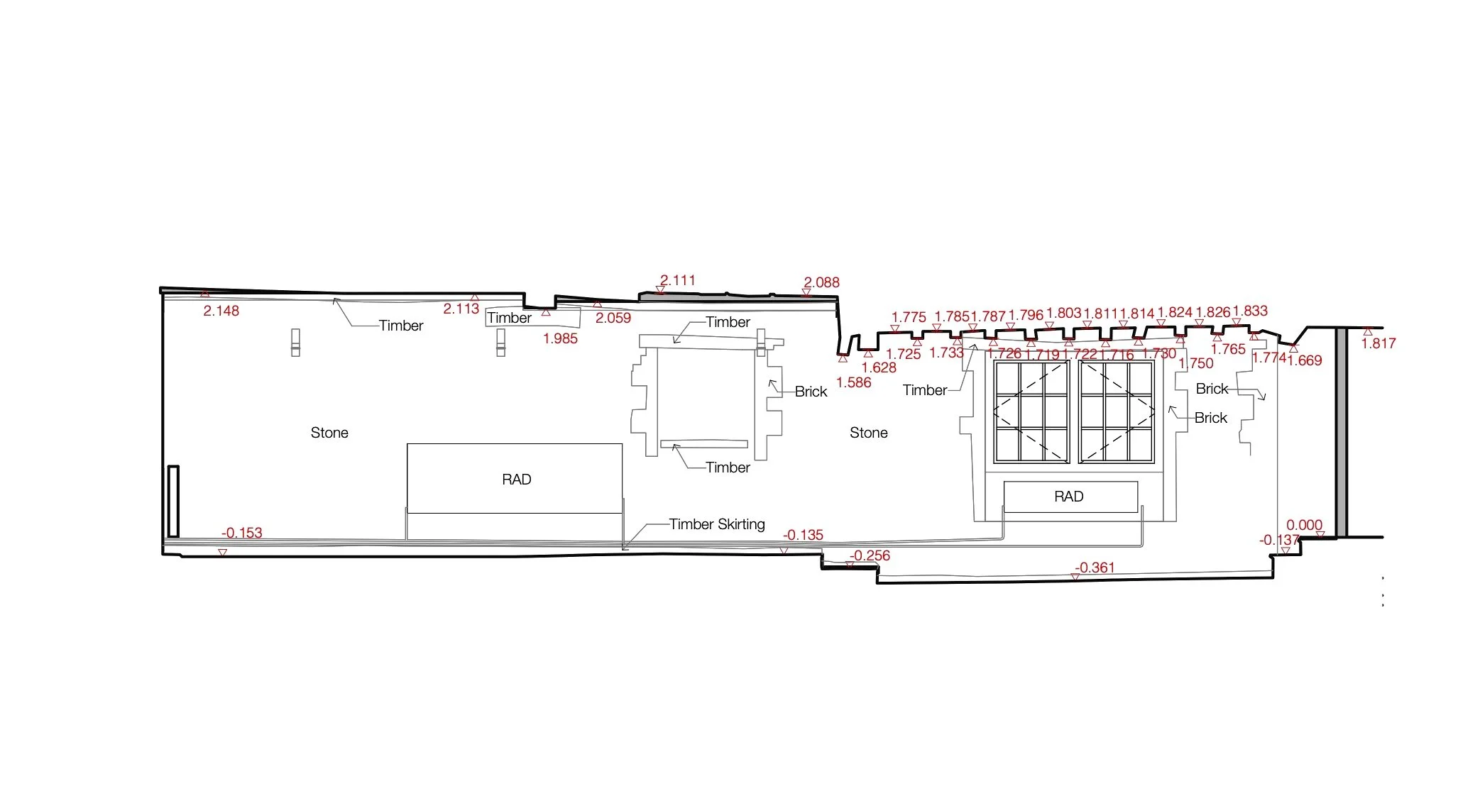
In a 500-year-old listed property, 3D scanning technology enabled us to build a precise BIM model, from which we generated highly accurate drawings such as this.
REVISITING OVERLOOKED ELEMENTS
Regardless of how insignificant an omission may seem at the time of producing the survey drawings, it could have significant ramifications later on in a project. With accurate scanned data, anyone can easily refer back to the original point cloud model to rectify or add any omitted elements. This means designers and architects never need to revisit the property to take additional measurements or photos, simplifying and speeding up the entire design process.
In one of our recent surveys (as shown in the image below), we were able to update a survey that we had issued to a client. At the time of the survey, the site was under construction and quite dusty, meaning we missed some of the outlets that were in the floor. Fortunately, having access to the scanned data allowed us to go back into the survey, analyse it in detail, and pick up what had been missed, all within a few minutes.
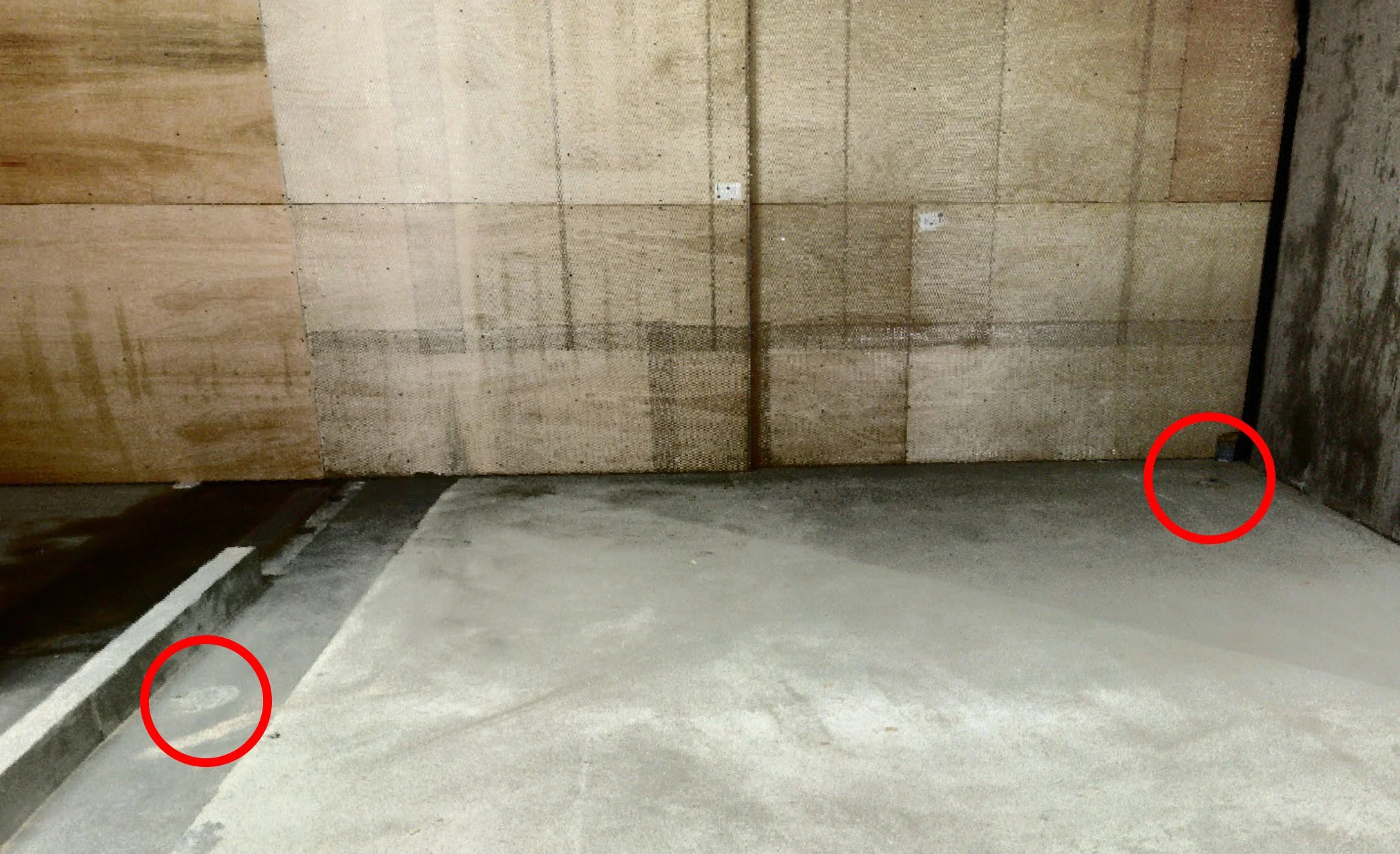
A recent site survey revisited to identify and document previously-missed floor outlets.
MORE EFFICIENT DESIGN PROCESS
3D scanning helps make the design phase of a project quicker, smoother and more accurate when it comes to checking measurements, raising plans or resolving errors. With an accurate 3D model in place, architects can focus more on the creative aspect of their work and less on checking measurements as the point cloud data always sits behind the model, accessible for reference whenever needed. This enables an efficient design workflow with fewer revisions needed and avoiding unnecessary delays.

Designers are able to measure any element of a project’s point cloud survey from directly within their BIM or CAD file
BETTER COLLABORATION
When multiple disciplines are involved in a project, as invariably they are, it is easy for miscommunications to occur. But with 3D scanning, everyone is working with the same survey data, whcih, crucially, is a visual resource. The whole design team has access to our Sphere XG site (formerly WebShare). This ensures everyone is on the same page, making collaboration easier, spotting issues and finding solutions together. Plus, it is a lot easier to communicate ideas when you can actually walk through the space in 3D together.
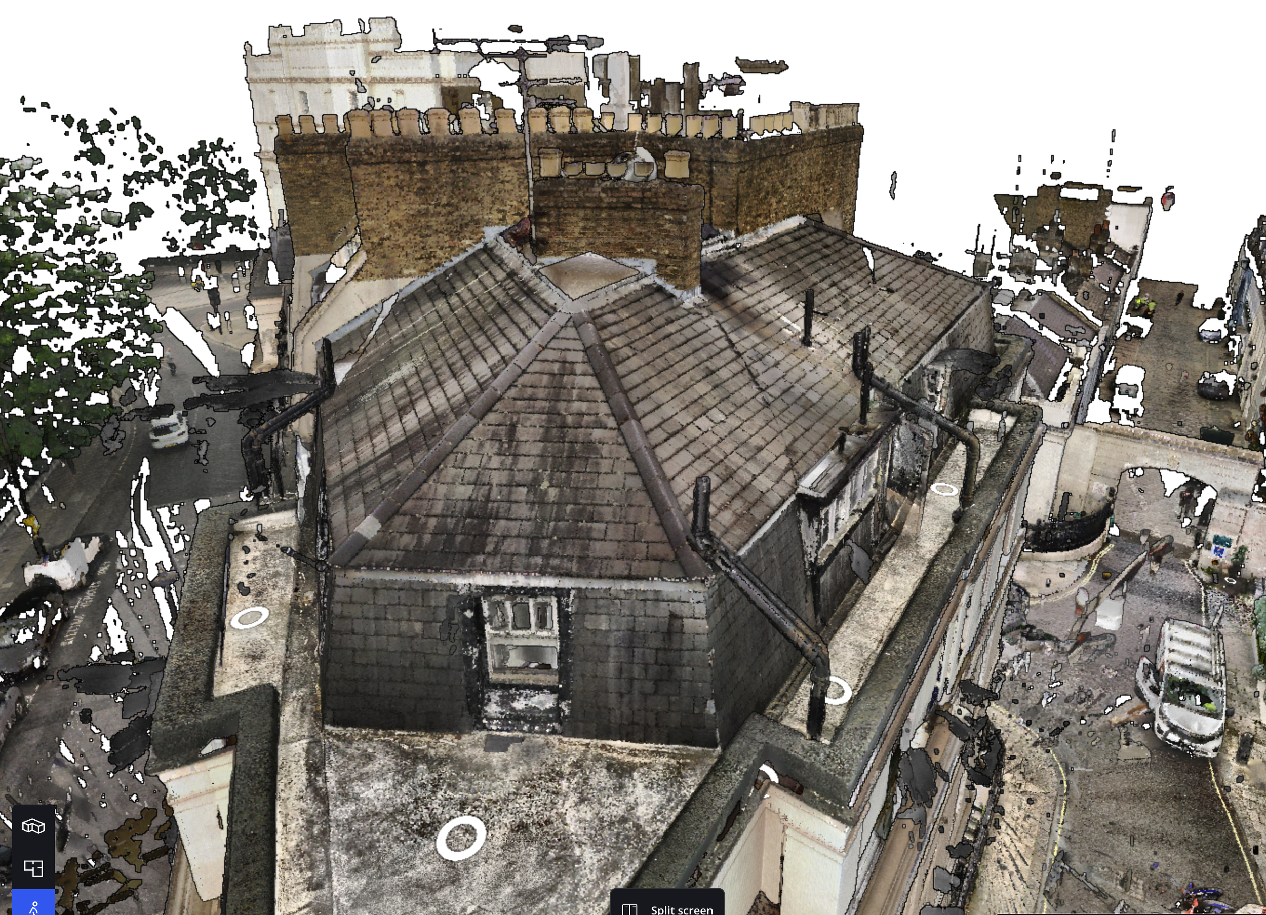
All design team members, from the structural engineer to the interior designer, can extract sufficient information from the point cloud model to develop their designs with full confidence
FEWER SITE VISITS
Frequent site visits can be time-consuming and eat unnecessarily into fees. With our 3D scans, architects and designers can visit the site virtually, inspect every detail, and analyse the space without leaving their office. This means less time spent travelling and more time designing!
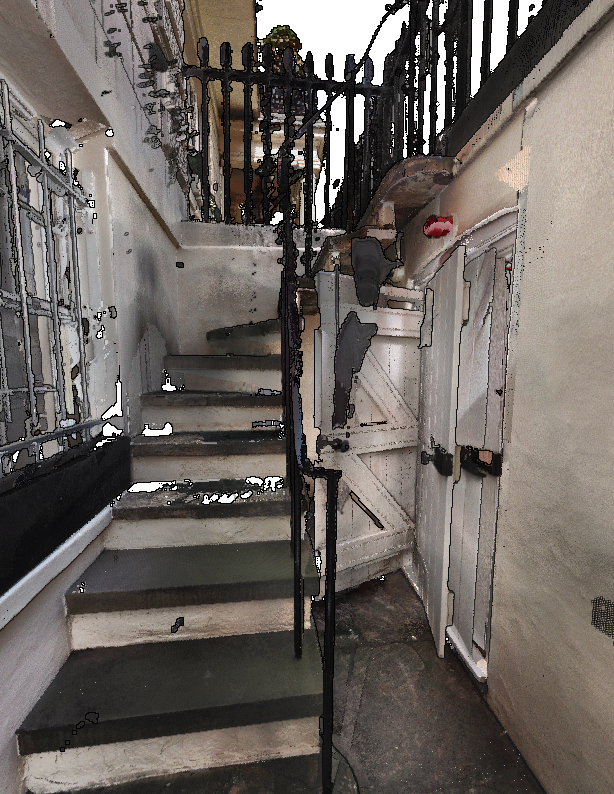
Using point cloud data to re-check elements of a survey
Our fast and reliable 3D measured surveys are carried out with the rigour and expertise that only architects can provide. If you would like to enquire about a survey, please contact us.