
Scanning Technology
How We Do It
All of our surveys use the latest laser scanning technology to capture every granular detail of the project. Our scanners capture accurate, complete and photo-realistic 3D representations of any environment in just a few minutes.
We always use the latest equipment to ensure that we provide the most efficient and cost-effective service to our clients. Our scanners are also recalibrated after every use to eliminate the risk of any deviations.
-
![]()
Point Cloud Capture
As an innovative architectural practice, we use advanced 3D laser scanning technology to carry out highly accurate measured building surveys.
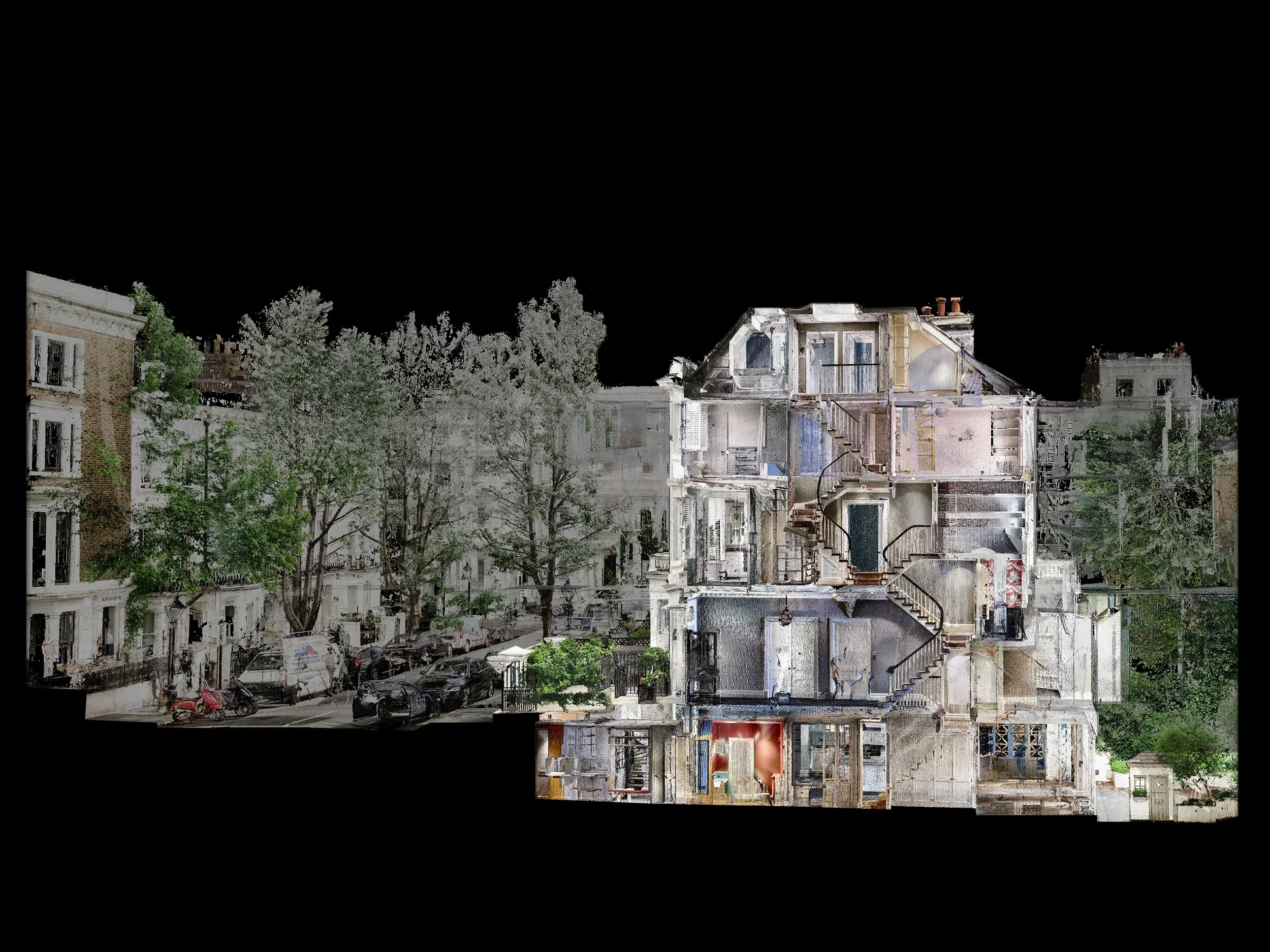
Our Faro scanners capture millions of individual data points across every visible surface of the building. Each point records precise X, Y and Z coordinates, along with RGB colour information, creating a detailed spatial dataset known as a point cloud.
When combined in a digital environment, these points form an accurate three-dimensional record of the building. This dataset provides the foundational geometry from which all subsequent drawings, models and measurements are derived.
-
![]()
360° Photography
At the same time, our scanners take a 360º panoramic photograph at each scan location.
These images are uploaded to our online client portal and can be navigated in a similar way to an indoor version of Google Street View, allowing project teams to visually explore the property long after the survey has taken place.
This allows project teams to visually explore the property long after the survey has taken place, providing valuable context that helps designers and consultants understand materials, details and spatial relationships throughout the building.
-
![]()
Data Processing
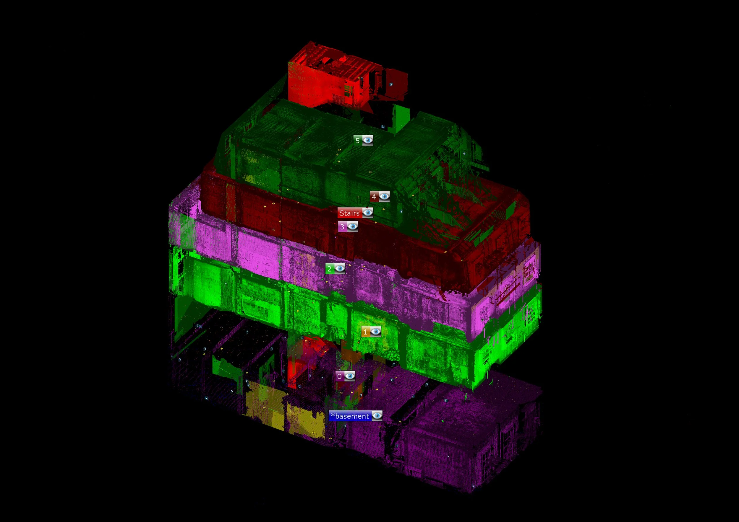
A typical survey may require anywhere between 100 and 200 individual scans to capture all visible surfaces of a property.
Our processing software identifies shared reference points between scans and merges them into a single unified point cloud model, ensuring the entire building is accurately aligned.
Every dataset is carefully reviewed by our team to guarantee the quality and precision of the final model.
Our team then interprets and traces the point cloud using specialist modelling software to produce accurate BIM models and measured drawings.

Laser scanning allows us to record buildings with exceptional precision, typically achieving a tolerance of ±5mm. The level of detail can be adjusted depending on the project brief, ensuring the dataset captures exactly the information required while allowing many surveys to be completed efficiently in a single visit.
Outputs
Once the point cloud has been processed, it forms the foundation for a range of outputs depending on the needs of the project. The raw spatial data can be interpreted and translated into a number of formats that support different stages of the design and coordination process.
These outputs typically include:
Interactive point cloud environments for remote viewing and measurement
Detailed BIM models providing an accurate digital representation of the building
Precise 2D architectural drawings, including plans, sections and elevations
Visual references through integrated 360° panoramic photography
Together, these outputs provide architects and project teams with a complete and reliable digital record of the building. This ensures that design decisions are based on accurate information from the very beginning of the project.