
From Point Cloud to BIM: How a Laser Scan Becomes a Digital Building Model

LA Surveyor, Colby McMillan
A 3D laser scan captures an enormous amount of information about an existing building, but what happens to that information afterwards depends on the requirements of the project. For some projects, the resulting point cloud may be used to produce accurate 2D survey drawings only, while for others, the information can be developed further into a detailed 3D BIM model.
In this article, Colby McMillan, Surveyor at LA Surveys, explores what happens after a building has been laser scanned, following the journey from the initial scan and creation of a point cloud through to the development of a 3D digital model, and the different ways this information can be used throughout a project.
Capturing the Existing Building
Laser scanning allows an existing building to be captured in three dimensions, recording the position of surfaces throughout the spaces being surveyed. While traditional surveys relied on taking individual measurements at selected points, modern laser scanning can capture millions of measurements across the building, providing a far more detailed picture of its existing geometry.
To build up a complete picture, the scanner is positioned at multiple locations throughout the building. Each position captures the areas visible from that point, with overlapping scans allowing rooms, corridors, walls, ceilings and other elements to be captured from different viewpoints. This is particularly valuable in existing buildings, where spaces can be irregular, difficult to access or different from the original drawings.
The result is a highly detailed digital record of the building's geometry. Rather than simply producing a list of dimensions, laser scanning captures the building as a whole, creating a foundation of information that can then be used to produce different survey deliverables depending on the requirements of the project.
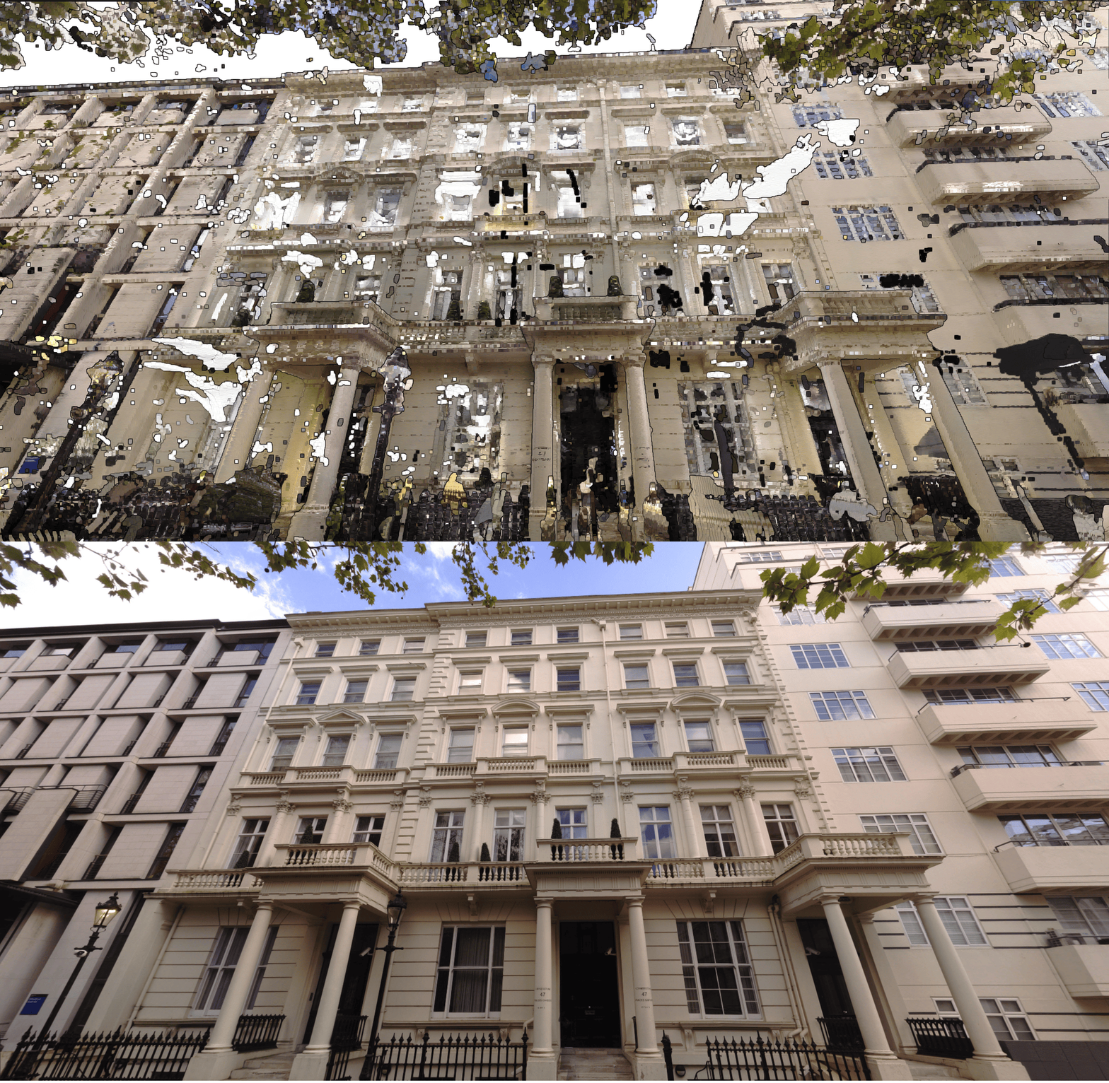
Instead of recording a handful of measurements, laser scanning captures the geometry of the building as a whole.
Bringing the Scans Together
Each position of the scanner produces an individual scan containing millions of measured points. On their own, these scans represent separate views of the building, so the next stage is to bring them together into one coordinated dataset.
This process, known as registration, aligns the individual scans with one another so that they accurately reflect their position within the building. By identifying common points and features between overlapping scans, the separate datasets can be combined into a single, complete representation of the surveyed space.
Once the scans have been registered and checked for completeness and accuracy, they form what is known as a point cloud. A point cloud is not a drawing or a 3D model of the building, but a digital representation made up of millions of measured points that collectively portray its shape and geometry.
The Point Cloud: A Digital Snapshot of the Building
Once the individual scans have been combined, the resulting point cloud provides a detailed digital snapshot of the existing building. It can be navigated just like a 3D environment, allowing users to inspect spaces, take measurements and investigate existing conditions without needing to return to site for every dimension or detail.
The point cloud can be used as a standalone survey deliverable, giving the wider project team access to an accurate record of the building as surveyed, something that LA Surveys automatically provides as part of every measured survey. It can also provide the foundation for producing 2D drawings or, where the project requires it, developing the information further into a detailed 3D BIM model.
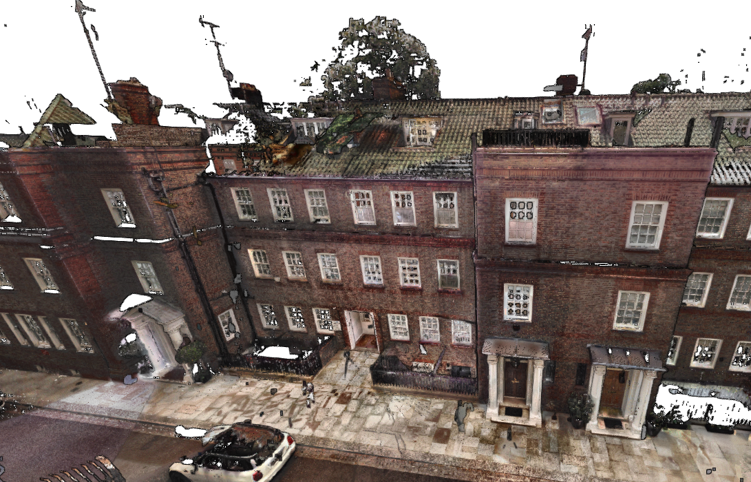
The building, captured digitally and ready to be explored.
Turning Data Into a Building Model
A point cloud provides an incredibly detailed record of the existing building, but it is not yet a building model. Where a project requires a 3D BIM model, the point cloud becomes the reference from which the building can be accurately modelled in three dimensions. Walls, floors, ceilings, roofs, windows, doors, stairs and other relevant elements can be modelled according to the geometry captured during the survey.
This is not simply a case of converting the point cloud into a model at the click of a button. Our experienced modelling team analyses and interprets the survey data, using the information captured within the point cloud to accurately model the relevant building elements within a BIM environment. The level of detail can then be developed according to the requirements of the project, resulting in an organised 3D representation of the existing building that can be viewed, measured and developed alongside the original survey information.
From 3D Model to Working Information
One of the key advantages of developing a 3D model from the point cloud is that it can become the basis for producing a range of 2D drawings and other project information. Rather than working back through the point cloud and interpreting the building separately for each drawing; plans, sections, reflected ceiling plans and elevations can be produced from the same coordinated model. A section, for example, can simply be created by cutting through the model at the required location, while the underlying geometry remains consistent across the different drawings.
The combination of a 3D model and the original point cloud also means the project can be revisited long after the initial survey. A project may initially require only general arrangement plans and a section, but months or even years later, additional information such as interior elevations may be needed. With the building already accurately modelled, producing this additional information can be significantly more straightforward, without needing to start the process of interpreting the existing building again.
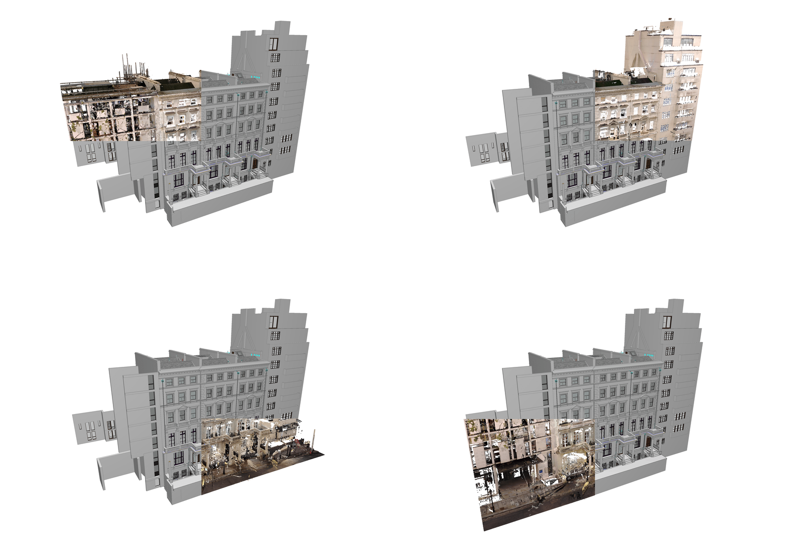
A single model provides the foundation for multiple drawings and future requirements.
Why the Process Matters
The quality of any digital building model ultimately depends on the quality of the information it is built from. A sophisticated model doesn't compensate for poor source information; in fact, it can make inaccurate information look more convincing. If a model is based on assumptions, incomplete measurements or inaccurate survey information, those inaccuracies can simply become embedded within the model and carried through into the drawings and design.
This is why each stage of the process matters. Accurate laser scanning provides a reliable foundation for the point cloud, which in turn provides the reference for an accurate BIM model and the information developed from it. By starting with a detailed record of the existing building, the project team can work with greater confidence, reduce reliance on assumptions and minimise the need for repeated site measurements as the project progresses.

The End Result
A laser scan is more than a collection of measurements. It captures the existing building in detail, creating a point cloud that can be used to produce accurate drawings or, where required, developed into a detailed 3D BIM model. The result is a digital representation of the building that can be explored, measured and used as the project develops.
Importantly, the value of this information does not necessarily end when the initial survey or project is complete. A well-developed digital model, supported by the original point cloud, can provide a lasting record of the building that can be returned to for future design, refurbishment and development. The question then becomes what else this digital representation can do for a building throughout its lifespan.
Don’t forget…
Our 3D measured surveys are fast, reliable, and delivered with the rigour and insight that only architects can provide. LA Surveys delivers a premium and unique service.
To discuss a project or request a survey quotation, please contact us.